Map of the Week – Science and Marine Research Installations

Celebrated annually on 10 November, World Science Day for Peace and Development highlights the significant role of science for peaceful and sustainable societies, addressing the need to involve the wider public in discussions about emerging scientific matters. This day also accentuates the importance and relevance of science in our everyday lives. This year, the theme is ‘Building Trust in Science’. It emphasises that enhancing trust in science is important to fuel the development and application of evidence-based solutions to various challenges our world currently faces, and to support science-based policy decisions.
Ocean science and management have a high potential to act as instruments for mitigating conflict and building peace [1] as well as promoting sustainable development [2] The continuous advancement in marine science and digital technology plays a vital role in supporting the well-being and stability of societies with direct or indirect connections to the marine environment. For instance, modern marine observation and research technology allows better understanding of the Ocean, the realisation of the importance of Open Data catalyses sharing of marine data hence the building of a Digital Twin of the Ocean (DTO ), development in artificial intelligence and machine-learning increases the precision of sea-level prediction and early hazard warning, etc. These technological transformations are fundamental to support sustainable resource management, marine biodiversity conservation, climate change mitigation, disaster preparedness and coastal resilience and maritime security. This also contributes to the success of Blue Economy as well as fostering regional and international cooperation both academically and diplomatically.
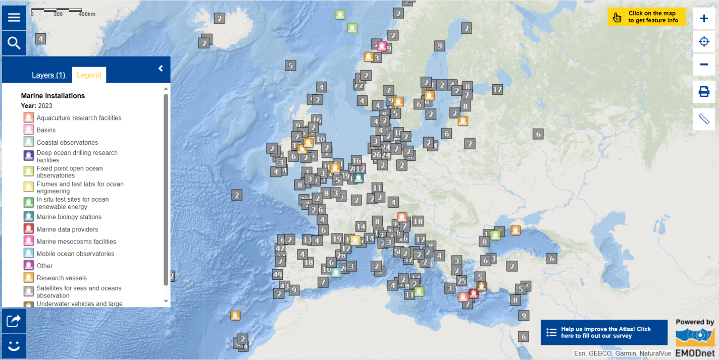
On this occasion, explore the Map of the Week on marine installations. This map shows the different facilities across Europe based on the Marine Research Infrastructures database from EurOcean , an independent, non-profit organisation committed to support advances of European marine science and technology. Check out the numerous types of marine installations indicated in the legend. A numeral is displayed when there are several installations within the same region. Zoom in the map to see the details! You can also click on the symbols to see the key characteristics for each marine installation, including links and contacts in order to access further information provided by the operators of these facilities.
Wish to learn more?
- Zoom into the map to discover the marine installations in your region!
- Dive into the UNESCO’s Ocean Literacy Portal to discover resources, meet experts and learn about events!
- Find out how UNESCO is #SharingHumanity .
- Discover what’s happening at the International Digital Twins of the Ocean Summit 2023 .
- Read the latest news related to the Ocean Decade .
The data in this map are provided by EurOcean .
