To understand the full benefits of EMODnet, users are kindly asked to describe how EMODnet supports them in their daily work and activities.
If you have developed an application using EMODnet products that you would like to share with us or if you use EMODnet data for other purposes, submit your use case by contacting secretariat@emodnet.ec.europa.eu.
Outcomes: Authors produced an extent-based evaluation of the representativeness and level of protection offered to the range of seabed habitats found in the Azore MPA network. The conclusions of the assessment highlighted the need for protection of bathyal and abyssal habitats, and to apply a suitable ecological coherence criterion to the MPA network.
How EMODnet Seabed Habitats helped the user:EMODnet was the first product to provide a broad-scale full-coverage map of the study region.
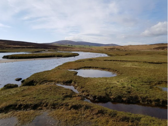
Marine Scotland Science (MSS) is the scientific division of the Marine Scotland Directorate, the branch of the devolved Scottish Government responsible for the marine and coastal environment. The purpose of MSS is to provide expert scientific, economic and technical advice and services on issues relating the to the marine environment, to provide evidence to support policies and regulatory activities of the Scottish Government, to perform regulatory and enforcement activitie
Outcomes: Authors calculated that 70% of Dipolydora habitat and 50% of Melinna habitat was in good ecological status under the Marine Strategy Framework Directive. The assessment provided the baseline for future assessments and could provide ecological information for future maritime spatial plans.
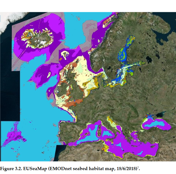
How EMODnet Seabed Habitats helped the user: The survey conducted for this study relied on the availability of habitat and substrate information, which EUSeaMap was able to detail.
Outcomes: Researchers were able to assess the impacts of decommissioning marine renewable energy installations (MREI) and provide advice for future decommissioning plans. It was found that the MREI in this area supported similar assemblages to the surrounding habitats, and therefore longer-term monitoring of habitat change were required.
How EMODnet Seabed Habitats helped the user:EMODnet provided broad-scale habitat data for the study area.
Wageningen Marine Research Institute is a part of the wider Wageningen University and Research centre. The marine institute conducts independent scientific research and provides contributions and advice on marine monitoring, spatial planning, sustainable marine exploitation, fisheries and nature-based solutions to climate change.
Wageningen Marine Research Institute is a part of the wider Wageningen University and Research centre. The marine institute conducts independent scientific research and provides contributions and advice on marine monitoring, spatial planning, sustainable marine exploitation, fisheries and nature-based solutions to climate change. They aim to work towards the more sustainable and careful management, use and protection of marine, coastal and freshwater environments.
Outcomes: The author was able to identify four regions of ecological significance along the Portuguese coast and assess the level of protection offered by Natura 2000 SPAs and SCIs. One of the hotspots was found to be only partially covered by the Natura 2000 sites, suggesting more quantitative-based approaches should be applied to assist management plans in safeguarding local biological value.
How EMODnet Seabed Habitats helped the user:EUSeaMap provided broad-scale seabed habitat maps and biozones for the study area.
Outcomes: Authors present a framework to assess the impacts of mobile fishing gear on the seabed and benthic ecosystems, the principles of which are applicable to all benthic habitats and trawl fisheries, and can be used across a wide range of spatial scales.
How EMODnet Seabed Habitats helped the user:EMODnet provided EUNIS Level 3 habitat maps across European waters.
Outcomes:Authors used an Ecological Niche Model to identify previously overlooked areas of the Mediterranean and Eastern Atlantic, as areas containing soft coral habitats. The model could then be used for future surveys to target areas predicting presence of coral habitats and identify new priority conservation areas.
How EMODnet Seabed Habitats helped the user:EUSeaMap provided information on the distribution of rocky bottomed habitats across the study area.
Outcomes: Authors present a framework to assess the impacts of mobile fishing gear on the seabed and benthic ecosystems, the principles of which are applicable to all benthic habitats and trawl fisheries, and can be used across a wide range of spatial scales.
How EMODnet Seabed Habitats helped the user:EMODnet provided EUNIS Level 3 habitat maps across European waters.