To understand the full benefits of EMODnet, users are kindly asked to describe how EMODnet supports them in their daily work and activities.
If you have developed an application using EMODnet products that you would like to share with us or if you use EMODnet data for other purposes, submit your use case by contacting secretariat@emodnet.ec.europa.eu.
EMODnet meets Dr Thijs Lanckriet, Advisor at International Marine and Dredging Consultants (IMDC). International Marine and Dredging Consultants (IMDC) is a company that provides expert advice for the sustainable management and development of our natural waters for public authorities, engineering offices and contractors on a worldwide base. We offer services in several areas...
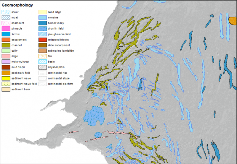
EMODnet Bathymetry data are used by most EMODnet Geology partners to describe and analyse the seabed. Coupled to data products on Seabed Substrate and Lithostratigraphy, geomorphology is being mapped both transnationally and at large spatial scales.
Symphony is a tool used by the Swedish Agency for Marine and Water Management (SwAM) to assess the cumulative impact of human activity in Swedish waters. In this operation, EMODnet Geology and the Bathymetry portals provided with good knowledge of the distribution of geological substrate types.
SINDBAD+, is a project co-funded by the European Commission (POR FESR 2014-2020), that aims at providing a service that can predict weather conditions and analyse its consequences on the navigation depending on the characteristics of the boat such as length, width and depth. The service targets luxury and leisure boaters. The SINDBAD partners use EMODnet Physics and EMODnet Bathymetry to initiate and validate data forecast models.
The availability of both depth data and geology data from one centralised point of contact (EMODnet) enabled Irwin Carr Consulting, an SME that provides specialist services that range from environmental noise, air quality, building acoustics and underwater noise, to be competitive and have efficient turn-around times on marine projects that otherwise would be delayed by prohibitively costly marine mapping work prior to impact assessments.
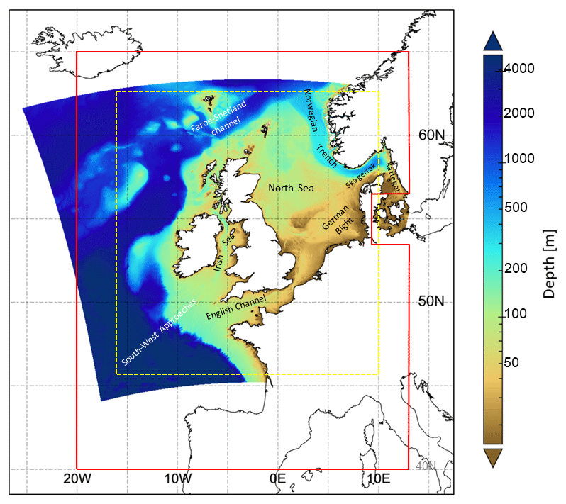
The Met Office provides forecasts of the ocean properties for the European North West Shelf through the Copernicus - Marine Environment Monitoring Service. In 2018, the forecast resolution was upgraded from ~7 to ~1.5 km. Validation at the basin scale and using typical metrics with daily means penalises the high-resolution system and does not reflect the superior performance of the high-resolution system. High resolution observations in selected areas of the model domain were crucial to demonstrate the improvement of the finer resolution model.
EMODnet is assisting the building of the infrastructure supporting a set of studies, carried out in accordance with the Spanish Environmental Impact Assessment procedure, needed to make the territorial and environmental diagnosis of the effects caused by the project. One example of these studies is represented by the paper published by the consultancy company Biosfera XX Estudios Ambientales where the data made available by EMODnet Bathymetry, Human activities and Seabed Habitats have been used.