To understand the full benefits of EMODnet, users are kindly asked to describe how EMODnet supports them in their daily work and activities.
If you have developed an application using EMODnet products that you would like to share with us or if you use EMODnet data for other purposes, submit your use case by contacting secretariat@emodnet.ec.europa.eu.
The Horizon Europe MSP4Bio project used EMODnet multidisciplinary marine in situ data, including from Bathymetry, Biology and many other thematic data, to inform an Ecological-Socio-Economic (ESE) management framework used for science-based MSP to safeguard and restore biodiversity in a coherent European MPA network.
University of Girona used EMODnet datasets in the Horizon EU project Blue-Paths, to develop a dashboard demonstrator with the goal to inform the wider audience about the geographic and social, ecological and economic characteristics of the high-potential areas for offshore wind energy in the Spanish sea space in a dynamic manner.
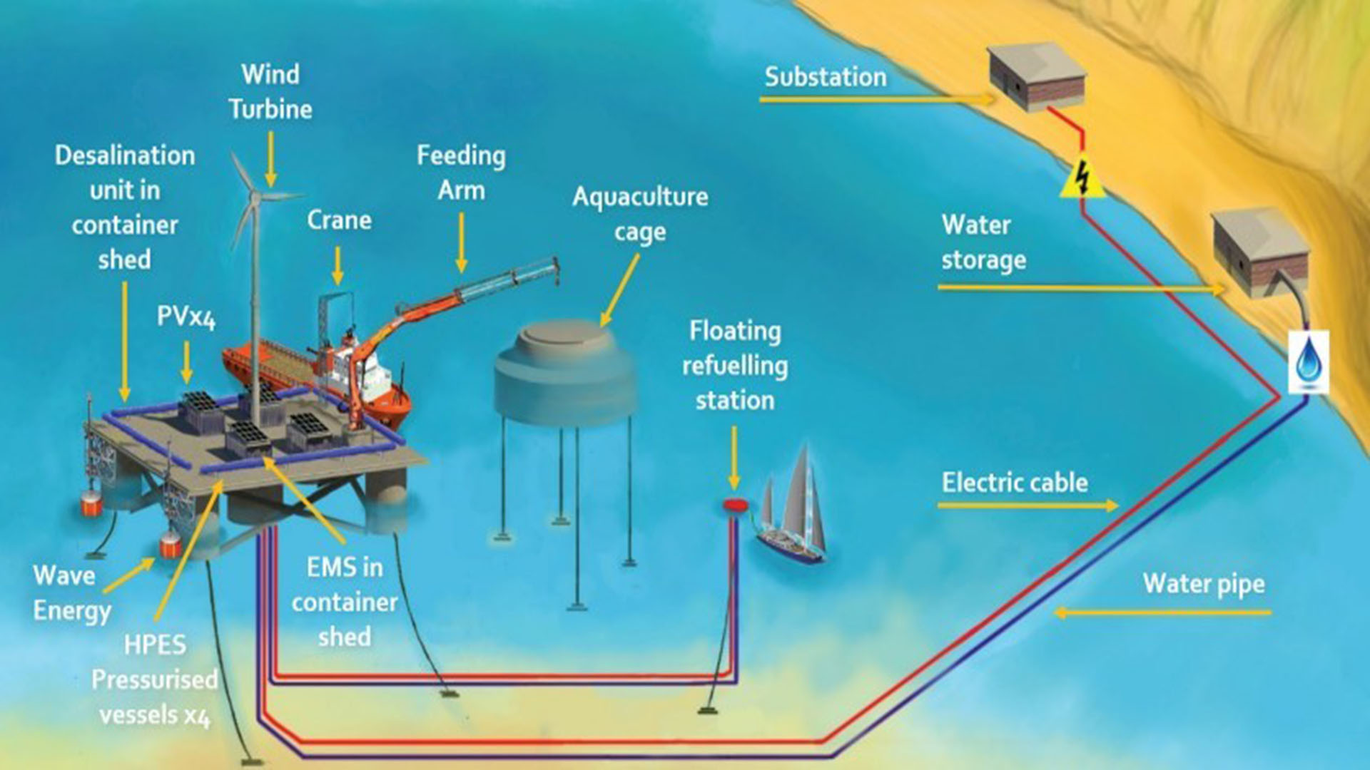
The University of Aegean is a partner in the MUSICA (Multiple Use of Space for Island Clean Autonomy) project, that developed a smart multi-usage of space (MUS) platform for the concurrent use of three types of renewable energy – wind, photovoltaic and wave – at small islands. The MUS also contributed to the advancement of a successfully tested multi-use platform (MUP), which was previously developed by the University of Aegean and the private company EcoWindWater. In the process of finding optimal siting areas for the MUP, MUSICA used EMODnet map services and data to highlight areas of potential constraints.
Croatian Geological Survey used EMODnet Geology, Bathymetry and Seabed Habitats data to develop the seabed substrate and geology maps within a project that aims to map the marine habitats of the coastal area of the Adriatic Sea up to a depth of 40 m and up to 200 m in protected areas.
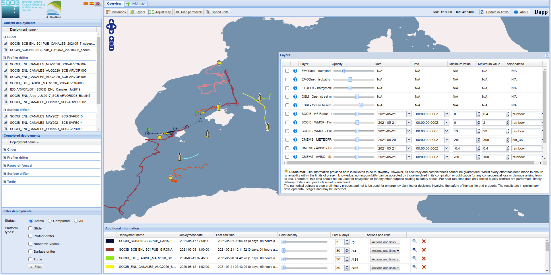
SOCIB Dapp is a web based client application, developed by the SOCIB Data Centre, intended to display and download deployments data either from SOCIB or third party portals such as EMODnet and Copernicus Marine. Dapp provides additional features such as: Browsing and displaying any deployments made by SOCIB, creating customized maps with several deployments and WMS map layers.
In a recent research paper (Effrosynidis et al., 2018), the Democritus University of Thrace (DUTH) aggregated CMEMS and EMODnet data to investigate the influence of environmental conditions on the presence-absence and the distribution of seagrass species over the Mediterranean Sea
The digital topographic map layers produced by EMODnet do not only show the depth of water, they also indicate where surveys are sparse and confidence in data is low. Extending this analysis for more distant waters requires collaboration with countries outside the EU who have similar programmes.
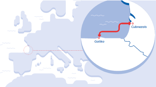
Biosfera XXI has been using EMODnet data since 2016, mainly for its marine projects, in particular, the environmental impact assessment project “The electricity interconnection across the Biscay Gulf".
EMODnet meets Dr Thijs Lanckriet, Advisor at International Marine and Dredging Consultants (IMDC). International Marine and Dredging Consultants (IMDC) is a company that provides expert advice for the sustainable management and development of our natural waters for public authorities, engineering offices and contractors on a worldwide base. We offer services in several areas...

")
 Ozren Hasan; b) Slobodan Miko, c), d), e) Ozren Hasan, f) Ante Žuljević")
 and the relation to the seabed substrates (EMODnet Geology).")