To understand the full benefits of EMODnet, users are kindly asked to describe how EMODnet supports them in their daily work and activities.
If you have developed an application using EMODnet products that you would like to share with us or if you use EMODnet data for other purposes, submit your use case by contacting secretariat@emodnet.ec.europa.eu.
The availability of both depth data and geology data from one centralised point of contact (EMODnet) enabled Irwin Carr Consulting, an SME that provides specialist services that range from environmental noise, air quality, building acoustics and underwater noise, to be competitive and have efficient turn-around times on marine projects that otherwise would be delayed by prohibitively costly marine mapping work prior to impact assessments.
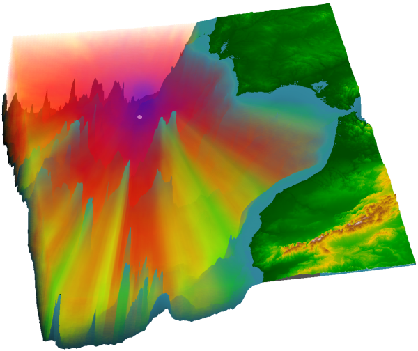
The Met Office provides forecasts of the ocean properties for the European North West Shelf through the Copernicus - Marine Environment Monitoring Service. In 2018, the forecast resolution was upgraded from ~7 to ~1.5 km. Validation at the basin scale and using typical metrics with daily means penalises the high-resolution system and does not reflect the superior performance of the high-resolution system. High resolution observations in selected areas of the model domain were crucial to demonstrate the improvement of the finer resolution model.
EMODnet is assisting the building of the infrastructure supporting a set of studies, carried out in accordance with the Spanish Environmental Impact Assessment procedure, needed to make the territorial and environmental diagnosis of the effects caused by the project. One example of these studies is represented by the paper published by the consultancy company Biosfera XX Estudios Ambientales where the data made available by EMODnet Bathymetry, Human activities and Seabed Habitats have been used.
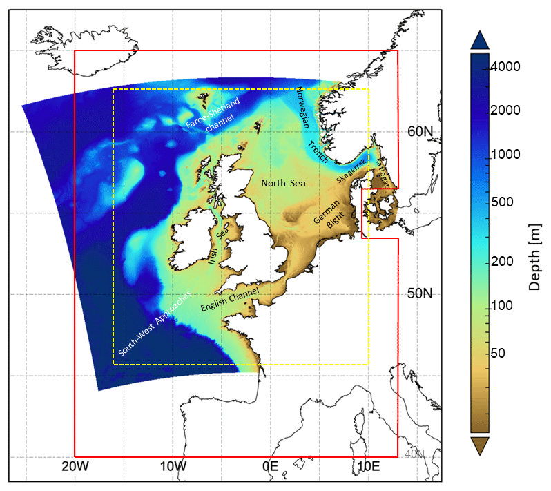
Changes in coastal sea level caused by the combined effect of surface winds and air pressure have the potential to cause widespread coastal flooding, damage to infrastructure and loss of life.
The low-lying lands bordering the North Sea are particularly vulnerable as was seen most notably in the catastrophic events of 1953. It is expected that climate change will increase the frequency and severity of such events.
In a recent research paper (Effrosynidis et al., 2018), the Democritus University of Thrace (DUTH) aggregated CMEMS and EMODnet data to investigate the influence of environmental conditions on the presence-absence and the distribution of seagrass species over the Mediterranean Sea
The digital topographic map layers produced by EMODnet do not only show the depth of water, they also indicate where surveys are sparse and confidence in data is low. Extending this analysis for more distant waters requires collaboration with countries outside the EU who have similar programmes.
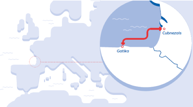
Biosfera XXI has been using EMODnet data since 2016, mainly for its marine projects, in particular, the environmental impact assessment project “The electricity interconnection across the Biscay Gulf".